In short: Around Gîte du Cruet in Saint-Eustache you can hike without a car: the Montagne d'Entrevernes (1,338 m, about 630 m of ascent as a loop) and the Fournis loop (6.1 km, 306 m) start from the hamlet or the village. By car, the Crêt de Châtillon on Le Semnoz, the Roc des Bœufs (1,774 m) and the Pointe de la Sambuy (2,198 m) are less than 45 minutes away.
The six hikes at a glance
| Hike | Start | Ascent | Duration | Level |
|---|---|---|---|---|
| Montagne d'Entrevernes (1,338 m) | The gîte, on foot | ≈ 630 m | 5 h – 5 h 30 (loop) | Fairly difficult (chain section) |
| Fournis loop | Saint-Eustache church | 306 m | 2 h 45 (6.1 km) | Easy |
| Laudon valley | Col de Leschaux | 550 m | 4 h 30 (13 km) | Easy |
| Crêt de Châtillon (Semnoz) | Semnoz ski area | 370 m | 3 h 30 (11 km) | Easy |
| Roc des Bœufs (1,774 m) | La Chapelle-Saint-Maurice | ≈ 720–750 m | 4 h – 4 h 30 (return) | Fairly difficult |
| Pointe de la Sambuy (2,198 m) | Seythenex ski area | ≈ 1,050–1,200 m | 5 h – 5 h 30 | Difficult (cables) |
Durations are approximate and exclude breaks. Check the weather and trail conditions before setting off.
1. The Montagne d'Entrevernes, from the gîte
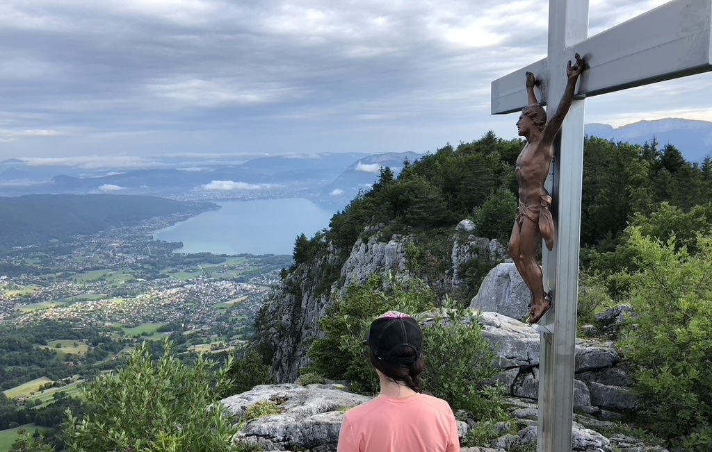
This is our signature hike: you walk out of the gîte, climb to the Col de la Cochette, then follow the ridge to the summit cross, with Lake Annecy at your feet. The descent via the Pas de la Cheville uses a fixed chain: avoid it in wet weather or if you suffer from vertigo. All the details are in our full route guide. An easier version exists: a return trip to the cross via the hamlet of Le Puget, about 570 m of ascent and 3 hours (Altituderando).
2. The Fournis loop, for families
Starting from the village church, this 6.1 km loop follows the Laudon stream and offers fine views of the Roc des Bœufs. With 306 m of ascent and about 2 h 45 of walking, it suits families (Bauges Park).
3. The Laudon valley, from Leschaux to Saint-Eustache
A long, gently descending walk through the valley, from the Col de Leschaux down to the village: 13 km, 550 m of ascent, about 4 h 30 (Altituderando). Ideal in autumn, when the forest changes colour.
4. The Crêt de Châtillon, summit of Le Semnoz
From the Semnoz ski area, 25 minutes from the gîte, an easy 11 km loop leads to the Crêt de Châtillon, the highest point of Le Semnoz, with one of the finest views of the Alps. Keener hikers climb from the Col de Leschaux (about 730 m of ascent) or via the Planay trail (about 950 m).
5. The Roc des Bœufs, the wild viewpoint
Above Saint-Eustache, the Roc des Bœufs offers a breathtaking panorama over the lake and the Bauges. It is climbed from La Chapelle-Saint-Maurice, via the Sollier chalets. The forest climb is steep. Our detailed route guide takes you step by step.
6. The Pointe de la Sambuy, for experienced hikers
A great Bauges classic on the Faverges side: 1,050 to 1,200 m of ascent depending on the route from the Seythenex ski area, with a final section equipped with cables and rungs. The panorama over the Aravis and Mont Blanc rewards the effort. More in our activity journal.
Before you set off
- The Bauges are a Regional Nature Park: stay on the trails, close pasture gates and keep dogs on a lead near livestock.
- Start early in summer to avoid the heat and afternoon storms.
- Take water: springs are rare on the limestone ridges.
- When you get back, the Fromagerie de la Cochette opposite the gîte awaits with cheese for your afternoon snack.